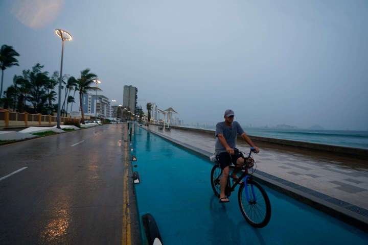
Hurricane Orlene, a Category 1 hurricane, made landfall in southwestern Mexico on Monday morning, unleashing heavy rain and strong winds. The storm crossed the coast just north of the state borders of Nayarit and Sinaloa at 7:45 a.m. local time, according to the National Hurricane Center.
Hurricane Orlene is coming ashore in southwest Mexico

Orlene, the 15th named storm of the Eastern Pacific hurricane season, intensified into a tropical storm on Thursday. Orlene then rapidly intensified into a Category 4 hurricane on Sunday, with sustained wind speeds of 130 mph, becoming the strongest storm of the year in the eastern Pacific Ocean.
Hostile high-altitude winds helped to weaken the storm, but Orlene still poses a threat to southwestern Mexico as it slogs inland as a Category 1 with 75 mph winds.
Hurricane warnings are in effect for the archipelago of Islas Marias and the mainland Mexican coastline from the town of San Blas to the city of Mazatlán, a popular tourist destination. Tropical storm warnings stretch farther, from the towns of La Cruz in the north and Tomaltán in the south.
Orlene — a small storm with hurricane-force winds that extend just 15 miles from its center — is expected to rapidly weaken as it moves inland and toward mountainous terrain, dissipating within two days. Still, it is forecast to drop dangerous amounts of rainfall.
On Islas Marias, widespread rainfall of 6 to 10 inches is forecast through Tuesday, with up to 14 inches possible. There, 20-foot waves or larger are possible as the storm churns offshore.
The Hurricane Center also warned that the storm would generate a dangerous surge, or rise in ocean water above normally dry land at the coast, through early Monday afternoon.
In the Mexican states of Nayarit and southern parts of Sinaloa, rainfall of 3 to 6 inches is forecast, with localized 10-inch totals — enough to cause flooding and spark landslides.
A dangerous storm surge and high waves are also possible along the coast. In response, the state of Sinaloa opened several storm shelters for those who need to evacuate from the immediate shoreline.
According to Reuters, the hurricane has prompted the closure of ports in the coastal states of Nayarit, Jalisco and Colima.
It has been a relatively quiet year in Mexico, which is used to seeing strong hurricanes threaten its coastline. Hurricane Agatha, the first storm of the season, made landfall in Mexico in May. No other storms posed a real landfall threat until Hurricane Kay — which also affected parts of California and the Desert Southwest — made landfall in Baja California in early September.
The Eastern Pacific hurricane season stretches from May 15 to Nov. 30 and is most active from July to early October, with activity quickly trailing off by the start of November.


