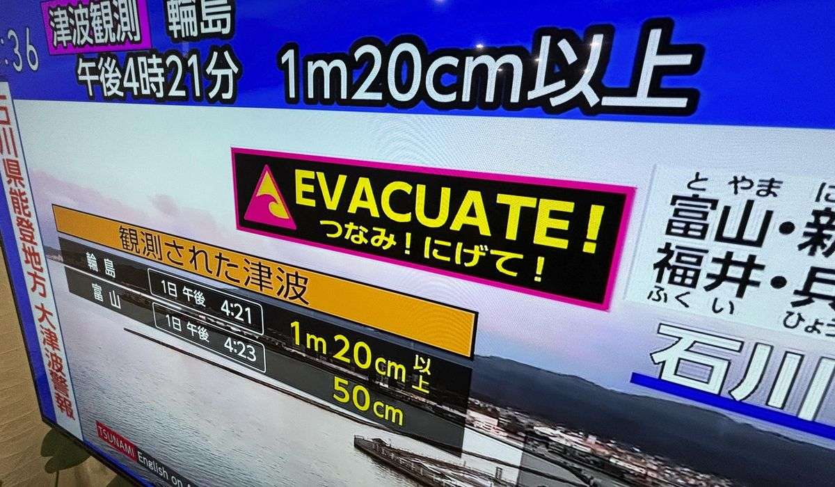
Federal Aviation Administration debuts faster East Coast air routes
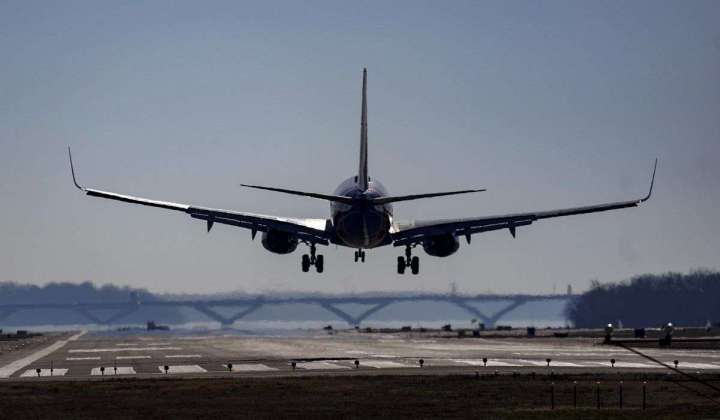
The Federal Aviation Administration announced new, faster air-travel routes for the East Coast, ahead of the summer travel season.
The FAA debuted 169 new routes Monday, most of which are at high altitudes of 18,000 feet or above. Whereas older, now-defunct routes zigzagged and followed ground-based radar installations, new routes are more direct.
An example provided by the FAA showed an older route, starting in central New York before jutting inward to western Pennsylvania, doing a small east-west zigzag in that state, then flying straight south towards southern Virginia, then going diagonally west across North Carolina to South Carolina, before then going south through Georgia and ending in central Florida.
The new route is much less circuitous, using GPS to follow the natural curve of the eastern seaboard from New York through New Jersey, Delaware, Maryland, Virginia, the Carolinas and Georgia without jutting far inland.
While the FAA’s new route map still shows a lot of old routes in the American interior, the East Coast is now covered almost entirely by the new GPS-using high-altitude paths.
Work on developing the new routes, with the aid of the air-travel industries, had been ongoing for seven years. Launched ahead of the peak travel season, the FAA estimates that using the new routes will save the planes that fly them 40,000 miles of distance and 100 hours of time annually.
With simpler routes, the FAA will also have more latitude to direct traffic to prevent delays.
“The new routes will reduce complexity and redistribute volume across all available airspace,” FAA Air Traffic Organization COO Tim Arel said.
Airlines are also pleased with the awaited updates to the routes.
“American has long been a proponent of unlocking additional high-altitude routes along the East Coast and we are optimistic they will have significant benefits for our customers and team members,” American Airlines COO David Seymour told CNBC.